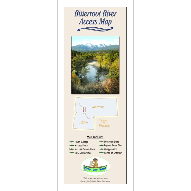
River Rat Maps
All anglers and floaters new to an area should purchase a map.
River Rat Map Features Include
- River Mileage
- Access Points
- Access Descriptions
- Diversion Dams
- GPS Coordinates
- Rapids
- Popular Game Fish
- Campgrounds
- Points of Interest
- Maps are in Color; 4″x10″ Folded, opens to 24″x10″
- Beaverhead Map – Clark Canyon Dam to Twin Bridges
- Big Hole Map – Wisdom to Twin Bridges
- Bitterroot Map – Connor to Missoula
- Blackfoot Map – Lincoln to Milltown
- Clark Fork #1 Map – Warm Springs to Frenchtown
- Clark Fork #2 Map – Frenchtown to Paradise
- Gallatin Map – Yellowstone Park to Headwaters State Park
- Madison Map – Hebgen Lake to Headwaters State Park
- Upper Missouri #1 Map – Three Forks to Wolf Creek
- Upper Missouri #2 Map – Holter Dam to Fort Benton
- Rock Cr. Map – Hwy. 38 Bridge to Clark Fork River
- Smith River Map – White Sulpher Springs to the Missouri River
- Yellowstone Map – Gardner to Big Timber
Reviews
There are no reviews yet.